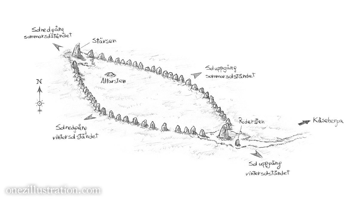
Back in mid-2018 Statens Fastighetsverk contacted me to create a map of Ale’s Stones and the town of Kåseberga, together with a handful of illustrations to be used in brand new information panels on location.
After a long wait, the new signs are finally up and if you visit Ales Stones you can use my map to get around the place! That’s pretty exciting!
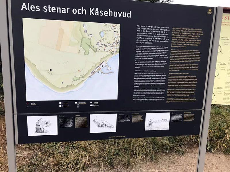
Photo: Niclas Karlsson / used with permission
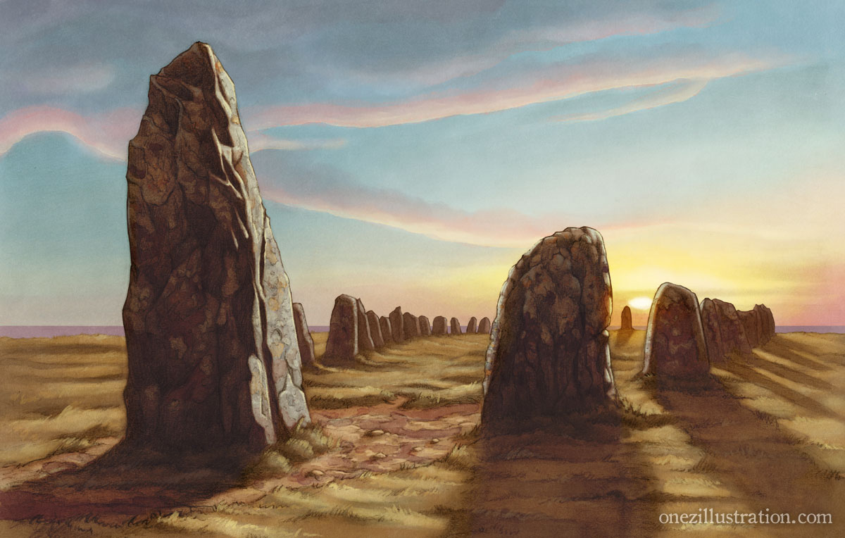
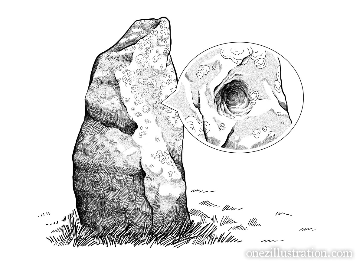
Ale’s Stones is one of Sweden’s most visited landmarks, an early iron-age monument consisting of 59 massive boulders arranged in a 67 metre-long ship shape. It dates back 1400 years to the Scandinavian Iron Age, but some claim the site is as old as 5500 years.
It is believed to be the burial site, and just like Stonehenge no one really knows what tits purpose was. Some theorize it was used as a landmark for seafaring, or as a sun calendar, marking the exact positions of sunset and sunrise during the summer and winter solstice.
There are also tales of ghosts from the Viking age haunting the area in their stone ship.
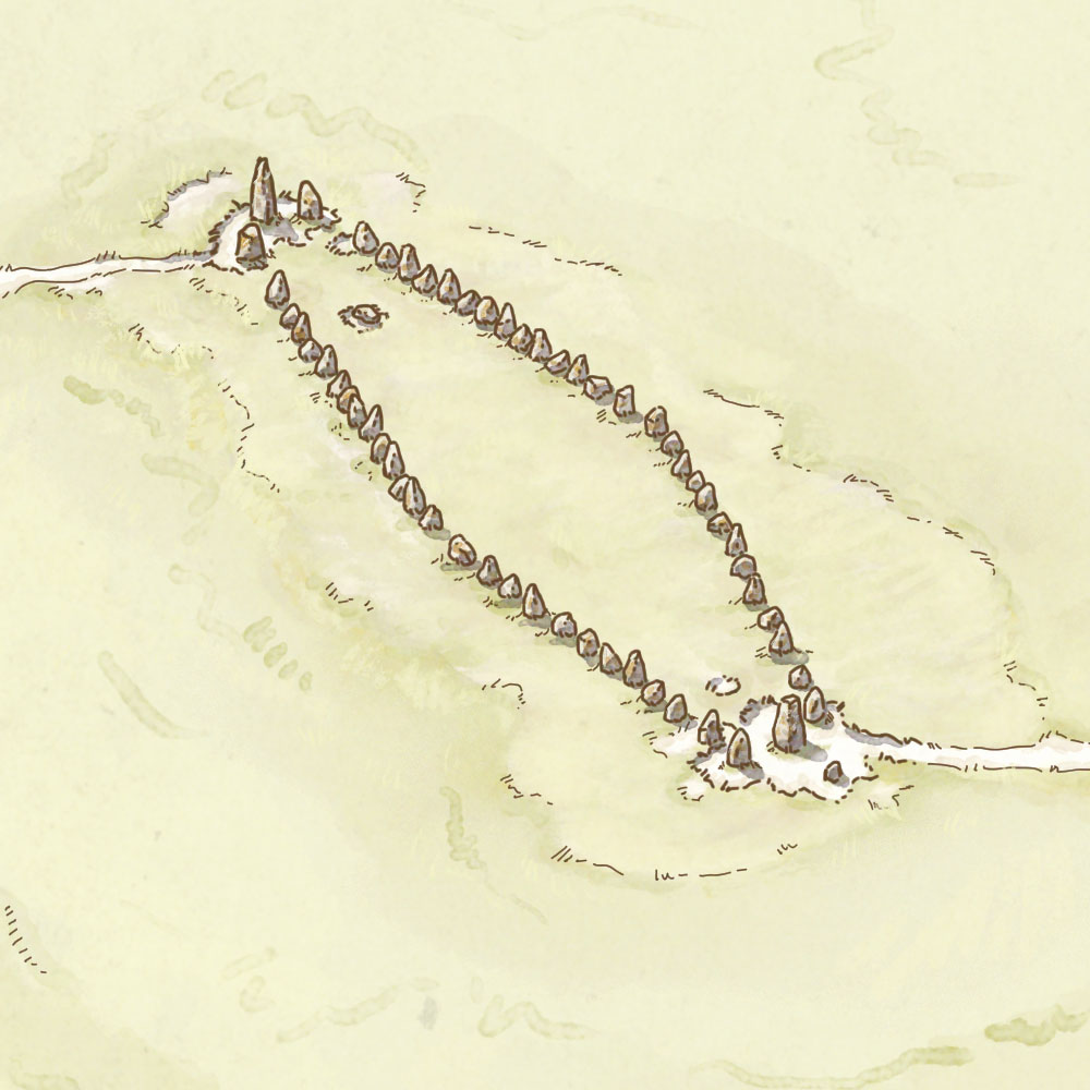
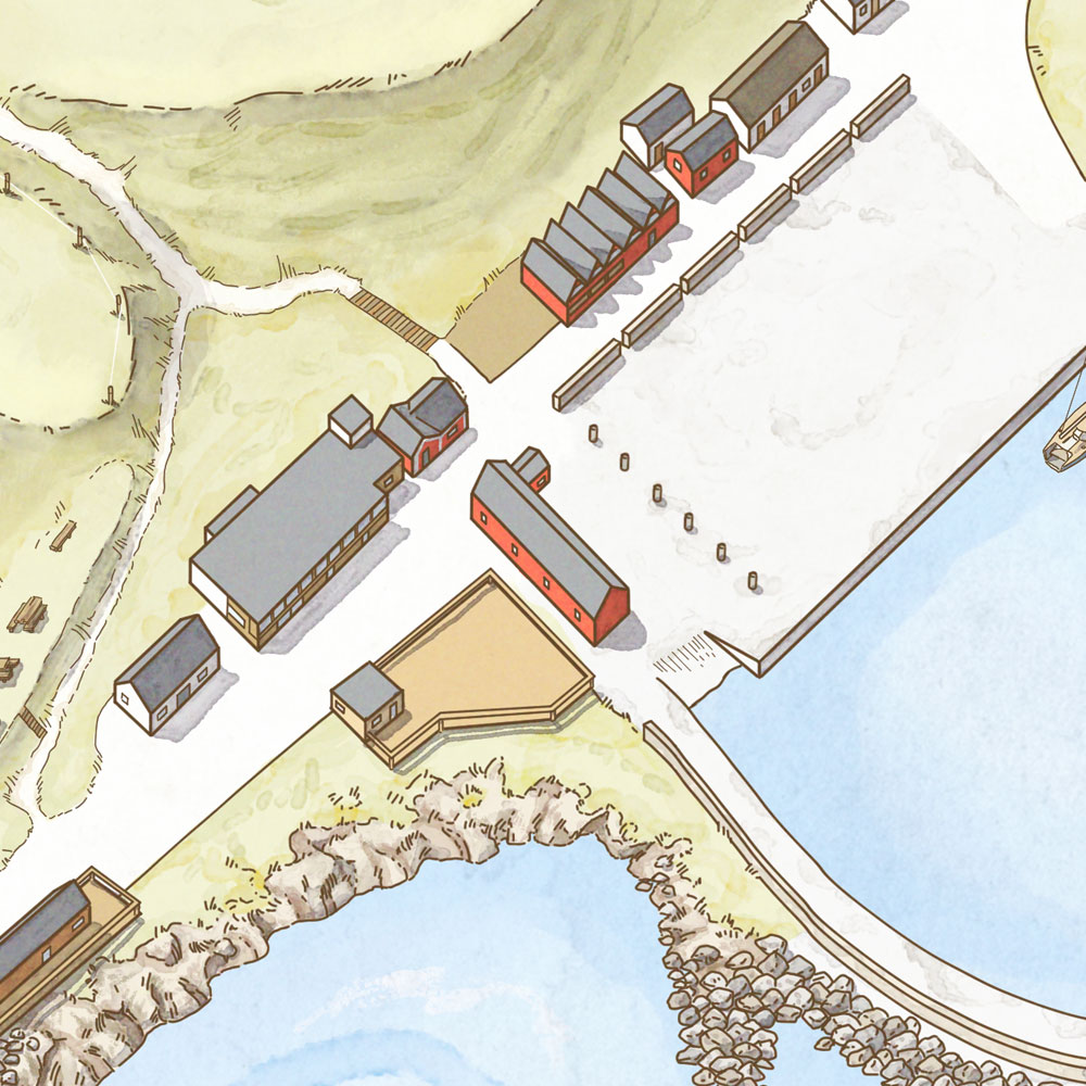
details from the map
This is not my first encounter with this mystical landmark though. Ale’s Stones in Lena Arro’s and mine 2017 book Från Döda fallet till Ales stenar – Platser med (spök)historia, a fully illustrated collection of 9 mysterious places in Sweden where history and folklore blend into each other.
You can see more of the book here, and you can order a copy here.
Prints from the book are also available from my RedBubble shop.