Map exercise: Trehörningen

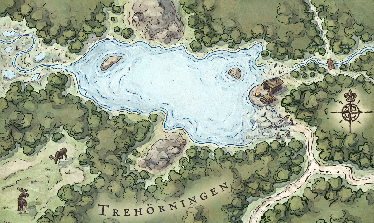
I did a little exercise map. I was inspired by one of my favourite spots in the forest near where I live. The lake is called Trehörningen (the triangle) and it has a very cozy wind shelter by the shore. In the area you can find lots of beaver architecture, and mires where sometimes moose can be seen grazing.

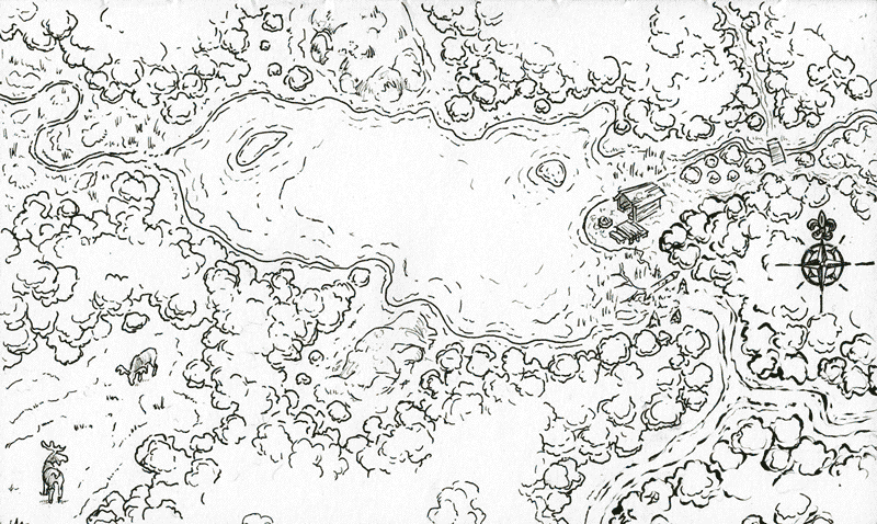
You can see on the lower right corner I started using a brush pen, but it offered too little stroke-control so I switched to multiliners 0.5, 0.25 and 0.05.

Copic multiners on paper, Photoshop.


Comments

Leave a Reply

Your email address will not be published. Required fields are marked *


Latest Posts

  • Tidsmaskinen: A picture book by 12 Swedish illustrators

    In early 2024 publisher Opal approached me with an idea for a picture book they developed together with renowned illustrator and author Sven Nordqvist. Their idea was for a so-called wimmelbook (or “hidden picture book”), where 12 Swedish illustrators would each create a personal interpretation of a historical place and…

    Read more…

  • Map of Scandinavia

    Present day countries and locations but with a touch of 15th and 16th (maybe even 17th) century cartography’s style and quirks. This is a remastered and expanded version of a black and white piece I made back in 2018 for the book Slaget om Salajak by Johan Theorin (published by…

    Read more…

  • Bridging the gap between comics and picture books

    When I was a teenager, during the 90s, all I wanted to become was a comic book artist, inspired by artists like Jim Lee and his work for X-Men. But most of all I was fascinated by Japanese manga. I grew up fully immersed in the worlds of Toriyama Akira…

    Read more…