The Atlas Awards 2018

Earlier in March the Cartographers’ Guild – of which I am a member – has announced the results of the 2018 Atlas Awards.

All maps submitted within the community during the previous year are eligible for the yearly award, which comprises several categories, like Most Creative Map, Best Regional Map, an so on.

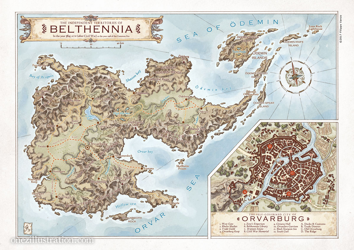
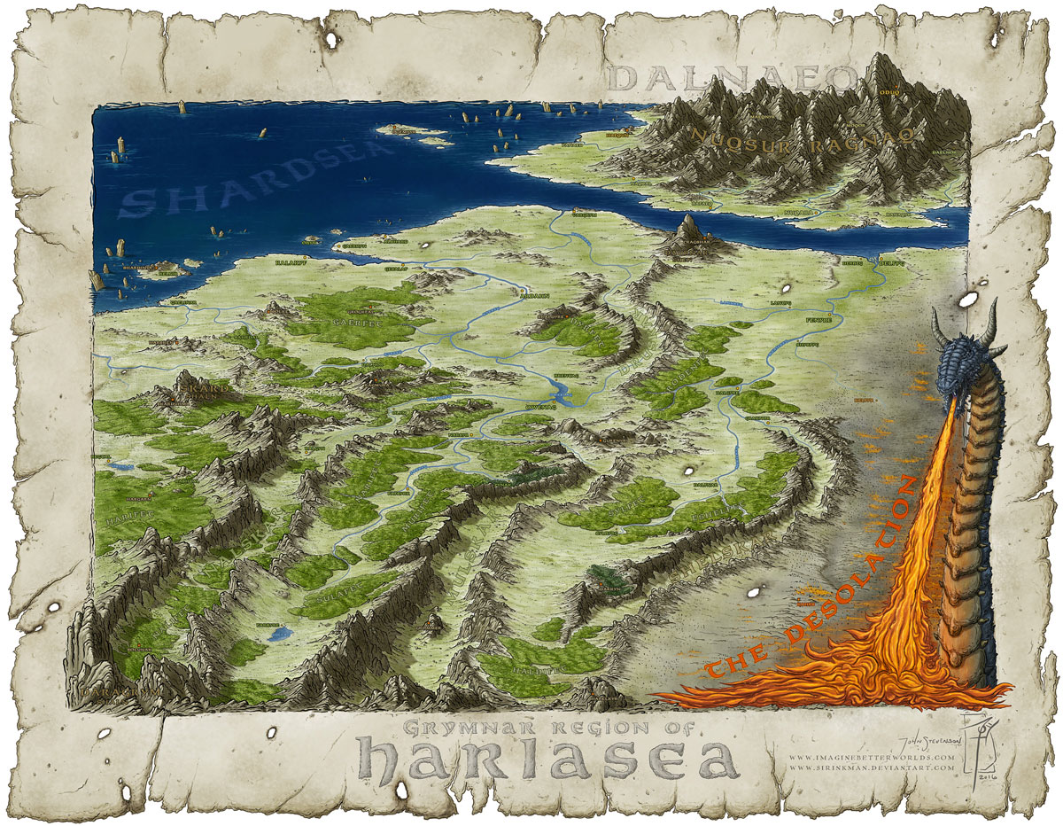
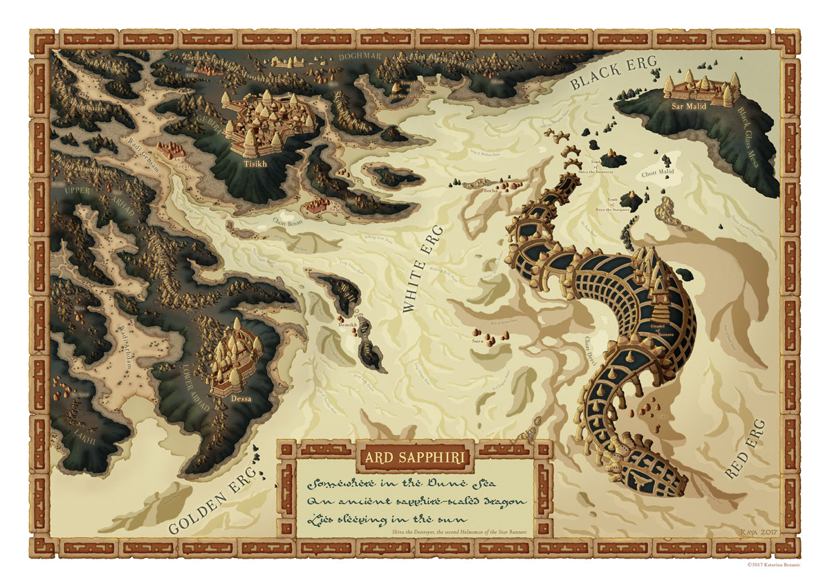
I am thrilled and humbled to announce that my map ‘The Independent Territories of Belthennia‘ was awarded Best Overall Map in a 3-way tie alongside ‘Harlasea’ by John Stevenson and ‘Desert Dragon’ Katarina Božanić.

The Independent Territories of Belthennia

I encourage you to check out the whole line up of winners, which includes gorgeous pieces by cartographers Francesca Baerald and Daniel Hasenbos.

Harlasea’ by John Stevenson
‘Desert Dragon’ Katarina Božanić

Comments

Leave a Reply

Your email address will not be published. Required fields are marked *


Latest Posts

  • Map of Scandinavia

    Present day countries and locations but with a touch of 15th and 16th (maybe even 17th) century cartography’s style and quirks. This is a remastered and expanded version of a black and white piece I made back in 2018 for the book Slaget om Salajak by Johan Theorin (published by…

    Read more…

  • Bridging the gap between comics and picture books

    When I was a teenager, during the 90s, all I wanted to become was a comic book artist, inspired by artists like Jim Lee and his work for X-Men. But most of all I was fascinated by Japanese manga. I grew up fully immersed in the worlds of Toriyama Akira…

    Read more…

  • My new book about Swedish monarchs is out!

    After almost two years of work, countless hours of researching historical sources, and just shy of 100 illustrations, mine and Linda Linnskog Rudh’s book about Swedish monarchs is finally complete and available in bookstores! Kungaliv : Sveriges regenter under 500 år, published by Opal, is a bustling non-fiction book for…

    Read more…